The Big Jump Towards Druid Hill Park Access

180816 Big Jump Madison Ave entrance

180816 Big Jump Madison Ave entrance

Listen: Urban Planning History and Park Access in Druid Hill Park, Graham Coreil-Allen, Maryland Humanities podcast, August 30, 2018

If you’ve recently visited Baltimore’s Druid Hill Park, you may have encountered a long row of orange and white plastic Jersey barriers running along the Druid Park Lake Drive and across the 28th Street Bridge. This is the Big Jump Baltimore shared-use path. Championed by local residents like myself, 7th District Councilman Leon Pinkett, Baltimore City Department of Transportation, and Bikemore, this temporary project counteracts decades of highway expansion with a protected space for pedestrians, wheelchair riders, and bicyclists to connect with green space, school, and jobs. Those of us living in West Baltimore certainly need it as for the past seventy years, walking or bicycling to Druid Hill Park has proven prohibitively dangerous. As a local resident and public artist, I’ve been working with neighbors on creating public art along the Big Jump pathway to make it safer for all people to enjoy the cultural and public health benefits of Druid Hill Park.

160706 Auchentoroly Terrace Druid Hill Park 8 lanes wide

Half of residents around Druid Hill Park do not own cars. So why does the area feel like a suburban highway? From the 1940s through the 1960s, car-focused transportation projects drastically changed the face of the park. The city’s goal was faster commute times for downtown workers living in the suburbs. Back then the surrounding neighborhoods of Reservoir Hill and Mondawmin were largely Jewish and African American communities. Proposed in 1945, the “Druid Hill Expressway” would convert Druid Hill Avenue and McCulloh Street to one-way thoroughfares connecting with a widened and extended Auchentoroly Terrace. By 1947 the highway plans had sparked a robust public debate

When the “Druid Hill Expressway” was proposed, NAACP Labor Secretary Clarence Mitchell Jr. argued that increased traffic speeds through westside neighborhoods would imperil black residents effectively barred by racist real estate practices from moving to the very suburbs that the highway would serve. Shaarei Tfiloh synagogue Rabbi Nathan Drazin expressed concern that traffic would endanger children attending Hebrew school as well as the throngs of congregants who traditionally walked down the middle of Auchentoroly Terrace during the high holy days.

Despite local outcry over the expressway plans, the three local council members were asked by area political boss James Pollack to ignore the opposition of their constituents and support of the “city wide” highway effort. In those days Pollack’s Trenton Democratic Club ran a political machine that effectively picked and elected all northwest Baltimore politicians. While the councilman had local independence, they dared not to cross Pollack over issues he considered important to the city at large. It didn’t hurt that the soon-to-be widened Auchentoroly Terrace just happened to end at Anoka Avenue – the calm, tree-lined street that Mr. Pollack called home. [Hat tip to my neighbor Dr. Daniel Hindman for discovering the connection to Pollack’s home.]  In the end, the councilmen appeased the local political machine and voted in favor of cutting down over 250 trees in Druid Hill Park to make room for widening Auchentoroly terrace into a highway flushing cars in and out of the central city at the expense of safe park access for west side residents.

Just a few years later Reservoir Hill residents in on the south side of the park found themselves facing a similar fate. In 1951 Mayor Thomas D’Alesandro Jr. proposed the Jones Falls Expressway. Druid Park Lake Drive would need to be expanded to serve as a feeder road to this new highway. Ensuing years of residents’ protests were ignored and construction began in 1956. Completion of the 1948 Druid Hill Expressway and 1963 Jones Falls Expressway resulted in the widening of Auchentoroly Terrace and Druid Park Lake Drive. Two-lane, park-front residential streets became dangerous five-to-nine-lane-wide highways difficult for people to traverse on foot, and virtually impossible to cross for wheelchair riders. These expressways literally paved the way for white flight while cutting off the surrounding working class African American and Jewish neighborhoods from the park. A park once served by over 20 footpath entrances is now only equipped with merely five sets of badly deteriorated, nearly invisible crosswalks.

2018 Druid Hill Park highways

Structurally racist urban planning decisions to build highways around Druid Hill Park made it difficult for the existing majority working class, people of color living in Auchentoroly Terrace, Mondawmin, Penn North, and Reservoir Hill to enjoy the park’s public health benefits, including exercise, cultural gatherings, healthy food, and clean air. The Health Department’s 2017 Neighborhood Health Profiles shows that the majority lower income, African American communities around the park have some of the city’s highest mortality rates of cardiovascular disease and cancer. Census data also shows that nearly half of neighbors around the park do not have access to cars. As pedestrians, wheelchair riders, transit users, and people who rely on bicycles, neighbors deserve priority access to the park.

180816 Big Jump pedestrian

Seventy years after the first highway was built around Druid Hill Park there is now a movement afoot to rethink how these barrier roadways can become connectors enabling more equitable access to our historic, 714 acre green space. In 2017, Councilman Pinkett convened the Druid Hill Park Stakeholders group to counteract years of urban planning that prioritized cars over the public health and economic opportunity of residents. We are pushing for “complete streets” to safely connect our neighborhoods with Druid Hill Park. Complete streets are designed and operated to be safe and accessible for all, including pedestrians, children, seniors, mobility users, transit riders, and bicyclists. Earlier this year Baltimore City Department of Transportation agreed to conduct a corridor study that has the exciting potential to address our community’s concerns. Leading up to this study, a newly created, temporary shared-use path now connects Reservoir Hill and Remington. The Big Jump Baltimore pathway previews what life could be like if we privileged all people, not just outside car commuters.

180816 Big Jump vinyl signage Remington

With the Big Jump temporary infrastructure now in place, myself and other residents and artists are adding public art enhancements making the trail more visible and usable for neighbors. In close collaboration with Bikemore, we’ve designed and installed creative wayfinding to show that the Big Jump Baltimore pathway is for everyone. Wayfinding consists of any number of sensory cues, such as signs, maps, textures and sounds, that provide travelers with orientation and possible paths. The Big Jump logo was designed by Danielle Parnes on behalf of Bikemore, with icon input from myself. I then adapted the logo to serve as pathway signage and wayfinding. For the Big Jump path we designed a street-sign-inspired logo featuring icons of the trail’s many different active uses, including but not limited to walking, wheelchair riding, bicycling dog walking, and skateboarding. We then went to our local makerspace Open Works and used their special equipment to cut the signage and icons out of adhesive backed, colorful vinyl. We used this cut vinyl to label and decorate the plastic jersey barriers so that both pedestrian and passing motorist can understand the purpose of the pathway.

180816 Big Jump Eutaw Pl entrance

To provide wayfinding for people not in cars we made our own set of large scale street stencils highlighting the pathway primary uses – walking, wheelchair riding, and bicycling. With these stencils we boldly marked the pathway as an active place for people. We also made several different footprint cutouts representing the people and creatures that travel daily between Druid Hill Park and surrounding neighborhoods. Stenciled with colorful traffic paint, these footprint trails visually lead residents from surrounding blocks to safe access points for the Big Jump Baltimore pathway and Druid Hill Park.

180816 Big Jump side street stencil wayfinding Eutaw Pl

Local residents deserve priority access to Druid Hill Park. The Big Jump Baltimore shared use pathway shows that through low cost traffic projects, public art and community collaboration we can make immediate positive impact on the lives of our neighbors. For the first time ever wheelchair riders and people who rely on bicycles can actually cross the Jones Falls Expressway. More work needs to be done, but the Big Jump is a step in the right direction towards reconnecting our neighborhoods with Druid Hill Park. Starting in 2019 Baltimore City DOT will be conducting a roadway alignment study through which residents will have the opportunity to shape how the city converts the dangerous highways around Druid Hill Park into “complete streets”: streets safe and accessible for all, including pedestrians, children, seniors, mobility users, transit riders, and bicyclists. In the meantime, it’s up to us take advantage of the Big Jump pathway while to creatively envisioning how our neighborhoods will one day reconnect with Druid Hill Park.

180830 Big Jump father and son bicyclists, photo by Brian O'Doherty www.odohertyphoto.com
Big Jump father and son bicyclists, 9/26/18, photo by Brian O’Doherty
180830 Big Jump Walking Tour with Graham & Ms Dee, photo by Brian O'Doherty
Big Jump Walking Tour 9/26/18 with Graham & Ms Dee, photo by Brian O’Doherty www.odohertyphoto.com

Listen to a version of this story on the Maryland Humanities Podcast: https://www.podbean.com/media/share/pb-cwqjv-9886f5

Click here to see more photos of Big Jump wayfinding: https://grahamprojects.com/projects/big-jump-wayfinding

Learn more about the Big Jump: https://www.bikemore.net/bigjump

Group photos courtesy of Brian O’Doherty: https://www.odohertyphoto.com

Read related letters to the editor by community leaders:

Op-Ed: Pinkett: We must make Druid Hill Park accessible, Leon Pinkett, Baltimore City 7th District City Councilman, Baltimore Sun, July 5, 2018

Op-Ed: Right a past wrong by opening access to Druid Hill Park, Daniel Hindman, Medical Doctor, Baltimore Sun, October 17, 2018

Op-Ed: Asphalt arteries cut off communities from Druid Hill Park, Davin Hong, Architect, Baltimore Sun, June 8, 2017

Choose Your Own Adventure at Artscape!

Choose Your Own Adventure

Choose Your Own Adventure

Its July in Baltimore, which means its time for the nation’s largest free art festival – Artscape! Building off of the outrageous success of last year’s Dancing Forest of inflatable trees, I’m now teaming up with with fellow Baltimore public artist Becky Borlan on Choose Your Own Adventure! Choose your own Adventure will transform the Charles Street Bridge at Penn Station into a colorful playscape of pedestrian pathways and hanging beach balls. Spray chalk lines will mark a site-based map converging under a forest of beach balls hanging from an open air structure.

Choose Your Own Adventure at Artscape 2018
Charles Street Bridge at Penn Station, Baltimore, MD, 21201
July 20-22, 2018
Friday: 11am-9pm, Saturday: 11am-9pm, Sunday: 11am-7pm
After hours: Friday and Saturday 9pm-11pm
Free and open to the public

Choose your own Adventure takes inspiration from the natural paths taken by street-crossing pedestrians, the Jones Falls and train tracks below, and the joyful experiences of summer-inspired toys. The kinetic environment will feature hundreds of colorful, translucent beach balls and multiple lounging options for festival goers to find respite from the summer sun. Participants who choose to explore will discover curious signs offering choices for adventures beyond. Through tactical urbanism and creative design, the installation will preview possibilities for completely transforming the Charles Street Bridge into an immersive pedestrian environment and playful visionary experience.

Behold the Land of Transportation Innovation

Baltimore Banner Vista

Baltimore Banner Vista

Join us July 4th, 4:30-6:30pm, for the official opening of Art on the Waterfront, a group show of temporary public art featuring the Baltimore Banner Vista. The Baltimore Banner Vista showcases the city’s past and future transportation innovations converging around Middle Branch Park. Participants are invited to sit at a marked spot on the fire pit ledge to see the life-size “postcard” blend into the surrounding landscape. The vista banner evokes the history of transportation manufacturing in Port Covington by depicting Ross Winans’ famous Cigar Ship constructed across the Middle Branch in 1858. The banner also features the proposed Baltimore-Washington Superconducting Maglev Train as well as a speculative anti-gravitational flight craft. The Baltimore Banner Vista inspires wonder and possibility for transportation advancements within this spectacular view of Baltimore City.

Click her for more photos of the installation: https://grahamprojects.com/projects/baltimore-banner-vista

Art on the Waterfront
Middle Branch Park, 3301 Waterview Avenue, Baltimore, MD 21230
Opening Reception: July 4, 2018, 4:30-6:30pm, followed by music by DJ ”Derrick Jennings” and Jonathan Gilmore, then fireworks at 9:30pm
On display July 4 – September 28, 2018

Art on the Waterfront features Becky Borlan’s Prisms, which pays homage to Baltimore City’s harbor and history of sailing; Graham Coreil-Allen’s Baltimore Banner Vista, which highlights the city’s past and future transportation innovations; Ashley Kidner’s Pollinator Hexagon, which draws attention to the importance of pollinator plants; and Matthias Neumann’s Basics #24, which explores an abstracted notion of form, space and utility in public sculpture.

Art on the Waterfront is produced by the Baltimore Office of Promotion & The Arts and supported by the Baltimore City Department of Recreation & Parks, South Baltimore Gateway Partnership, the City of Baltimore, and the Baltimore Casino Local Development Council.

Sun Stomp opens at Light City

Sun Stomp projection and bleachers

Sun Stomp projection and bleachers

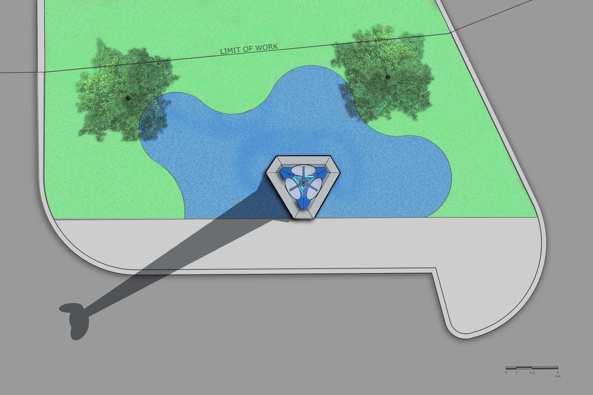
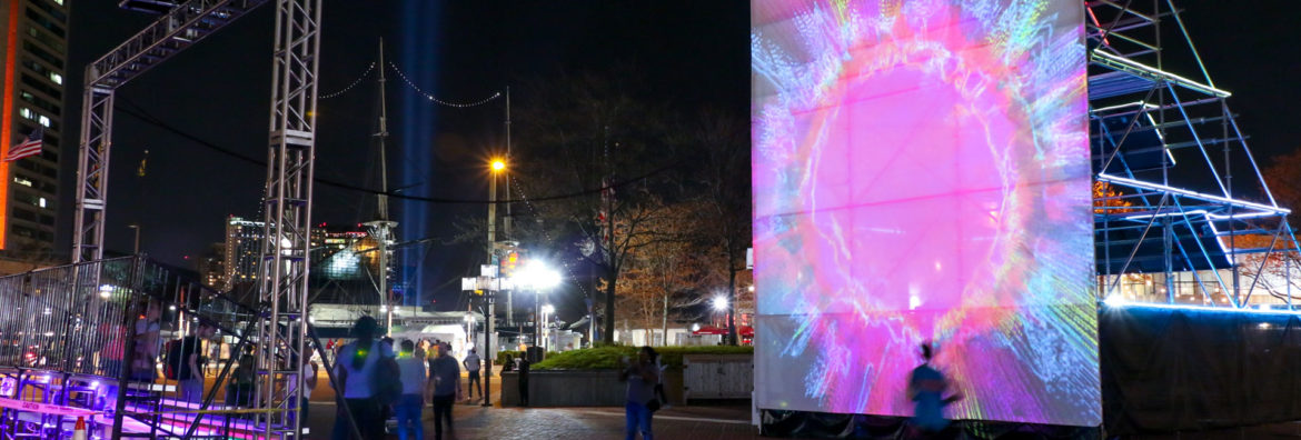
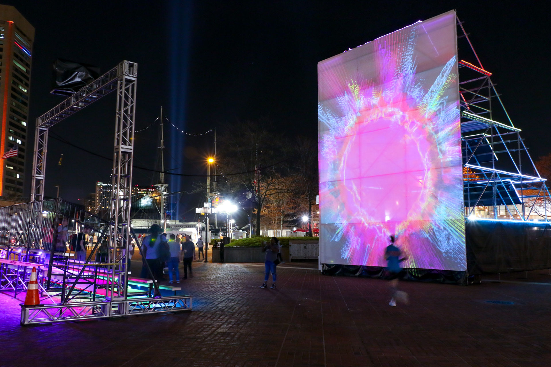
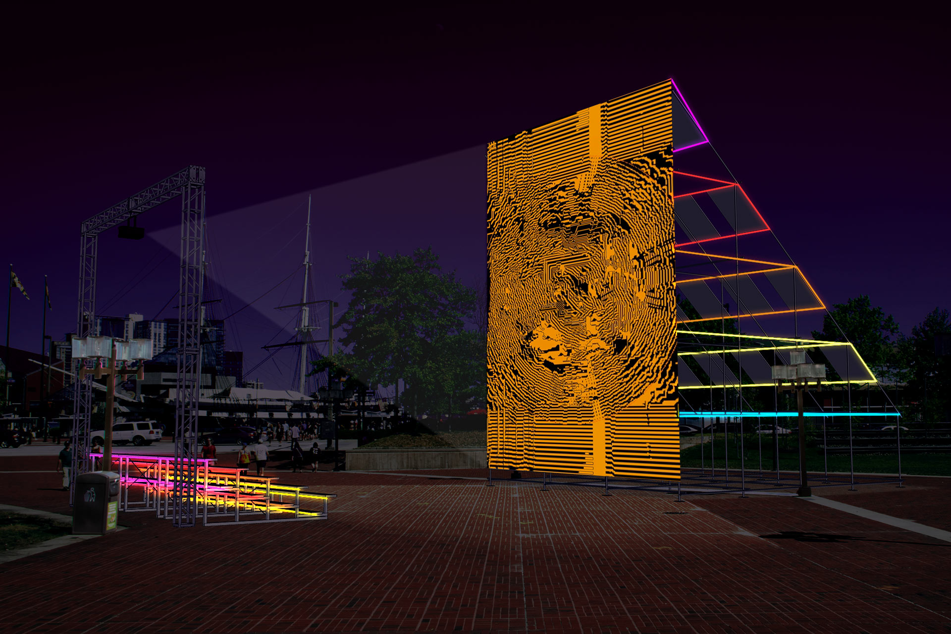
Experience the power and beauty of the sun through Sun Stomp! Sun Stomp is a solar powered LED display and sun-inspired, interactive audio-visual environment at Baltimore’s third annual Light City festival. The massive public art project is a collaboration between public artist Graham Coreil-Allen, video artist Mark Brown, and solar engineer Matt Weaver.

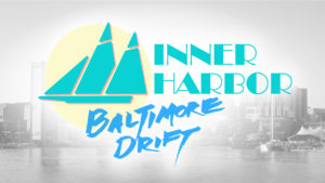
Sun Stomp will be awaiting your foot-powered activation each evening, April 14–21, in the gateway to Baltimore’s Inner Harbor, McKeldin Square. The installation is Stop 24 on the Light Art Walk, on the southside of Pratt Street between Light and Calvert Streets.

What: Sun Stomp, a solar powered LED display and sun-inspired, interactive audio-visual environment at Light City
When: April 14-21, 2018, 7pm-12am weekends, 7pm-11pm week nights
Where: Light City stop #24, McKeldin Square
101 E Pratt St, Baltimore, MD 21202, USA
Free. More info: http://sunstomp.art & https://lightcity.org
Audio Tour: 410-934-7821 enter 8#

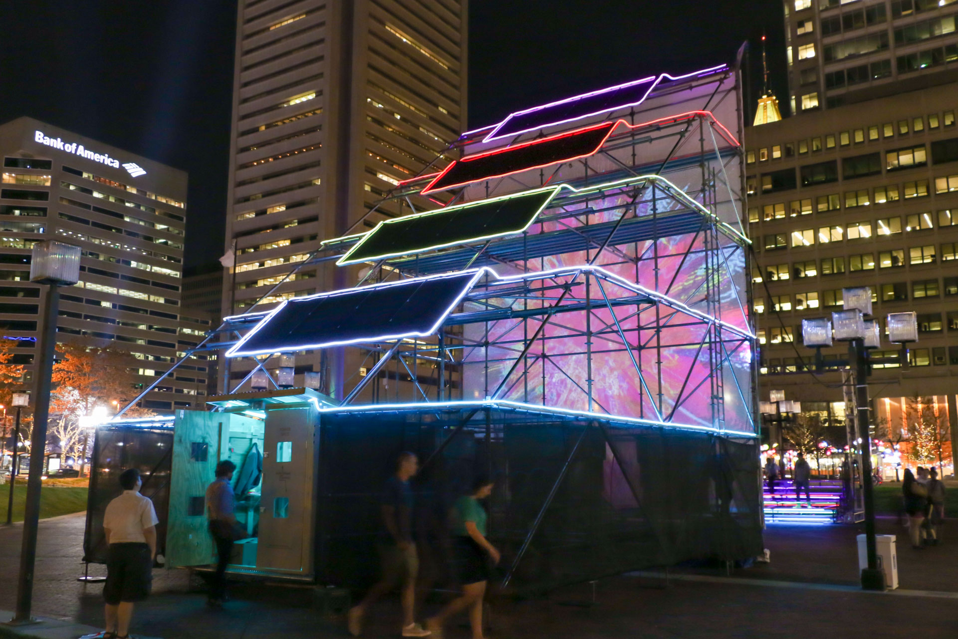
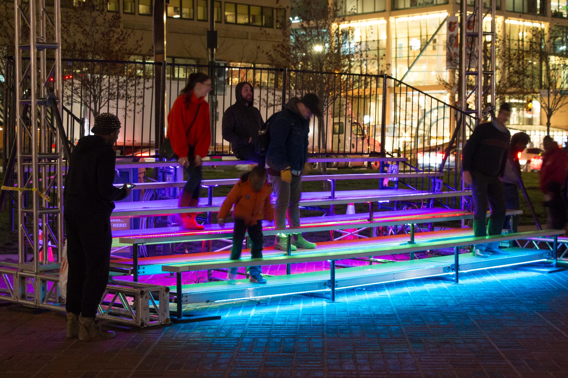
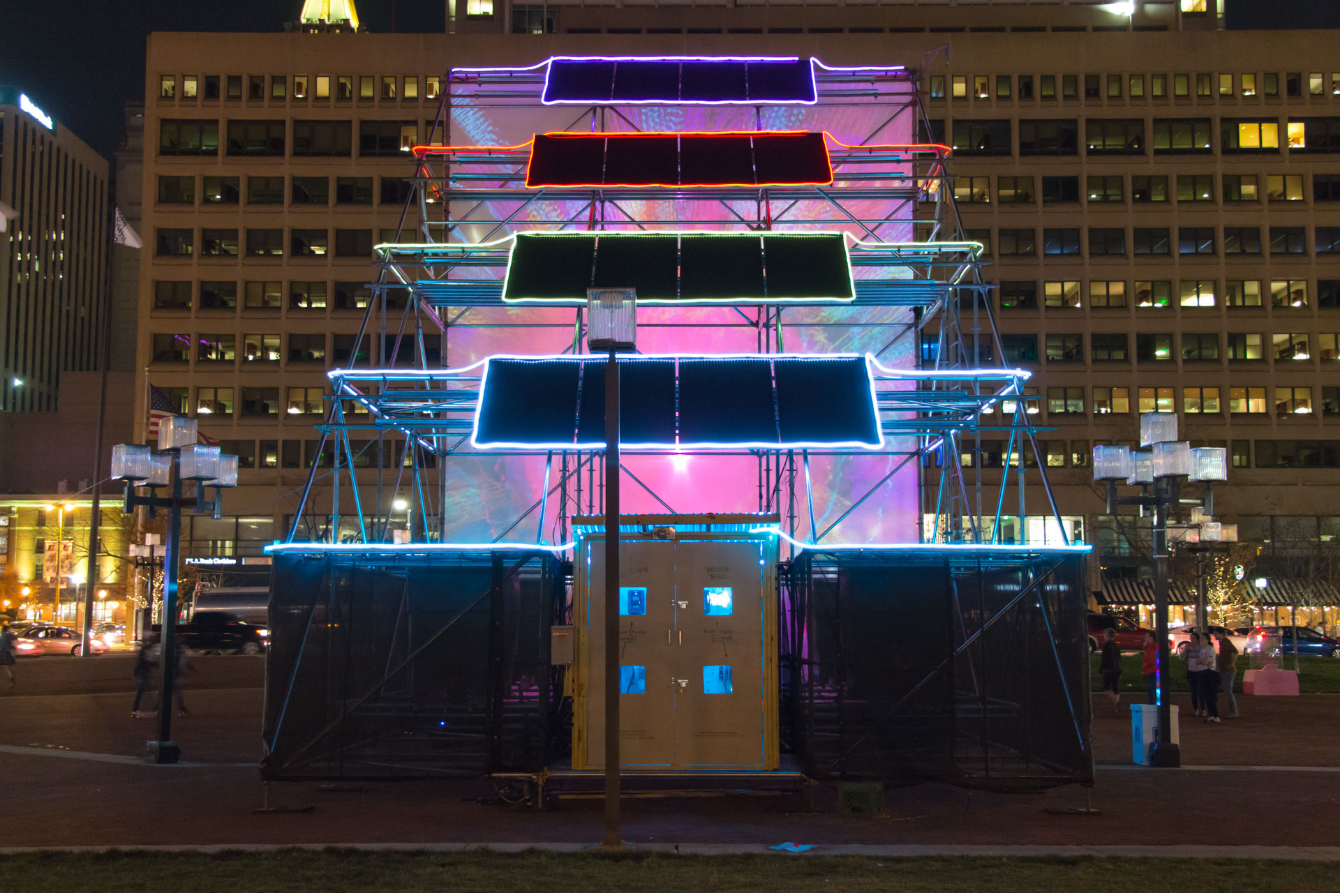
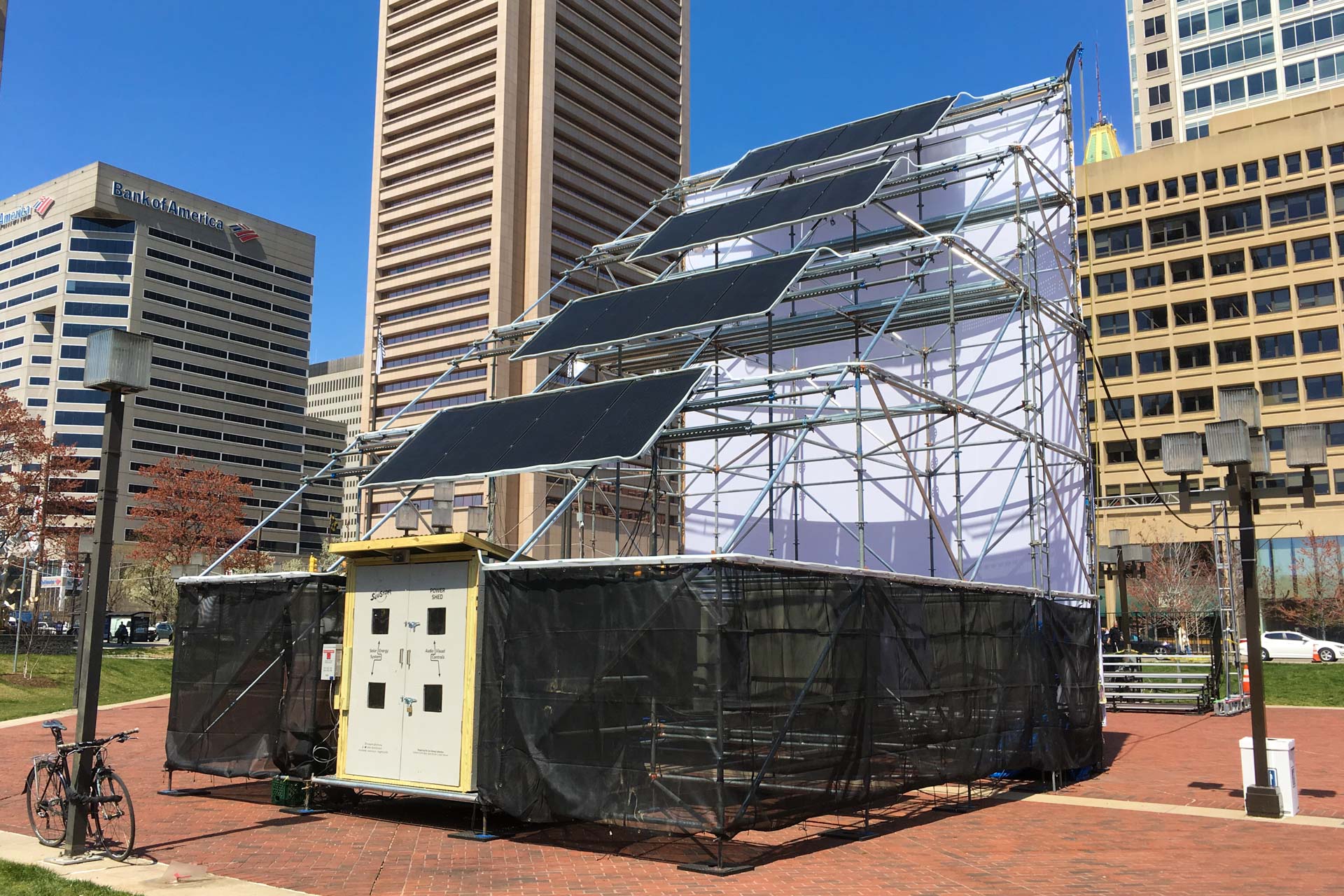
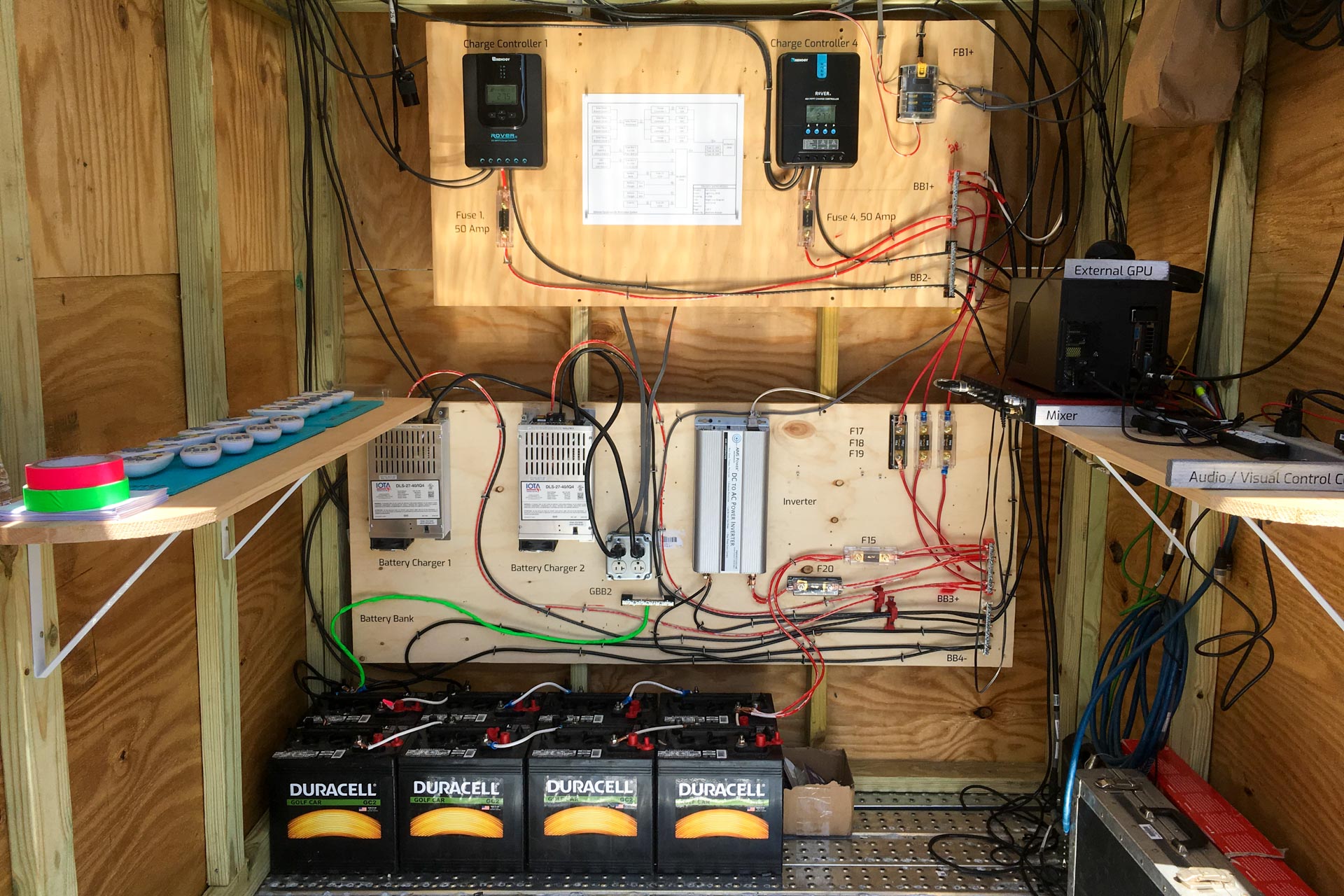
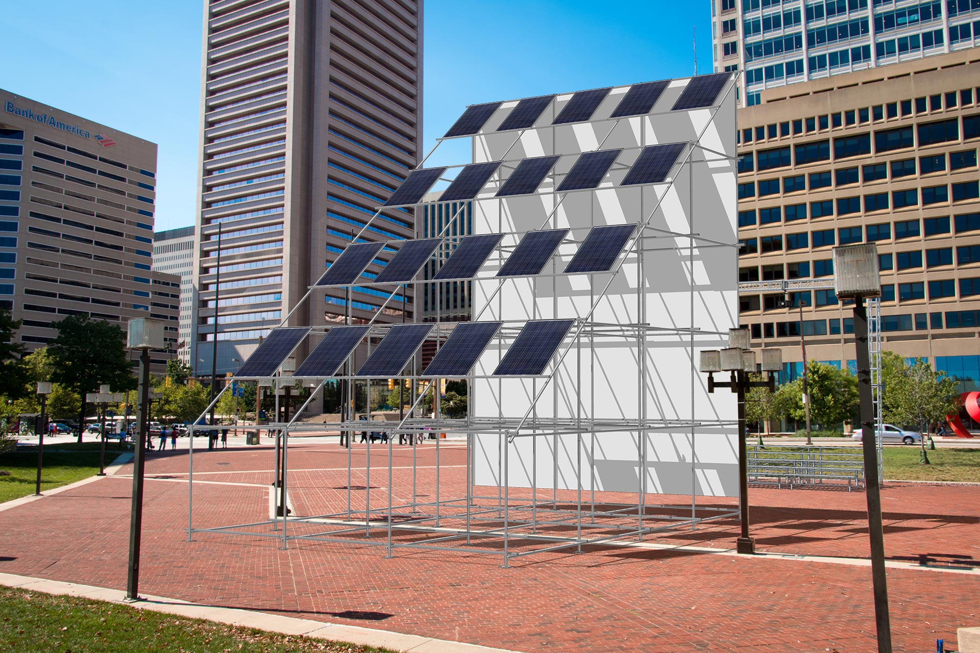
Sun Stomp features a 34’ tall scaffolding sculpture with an interactive projection on one side and an array of sixteen, 290 watt solar panels on the other. Electrical Energy is collected during the day and stored as chemical energy in a battery bank in our Power Shed, which provides electricity to the colorful array of LED neon lights illuminating the structure after dark. Participants are invited to stomp on the bleacher footboards to trigger sun-inspired projected visuals, increase the LED brightness, and amplify sounds of the Sun sourced from NASA’s Solar Dynamics Observatory.

Solar and Storage Statistics:

  • Sun Stomp features 527 feet of LED lighting.
  • All 16 solar panels provide 4,640 Watts per sun hour or 23,200 Watts per day in April.
  • The average home in Baltimore uses 7,546 kilowatts per year; the same amount of electricity produced by these 16 solar panels and stored by the Battery Bank.
  • The 16 solar panels installed on a home would save $1,052 annually in electricity charges.
  • During Light City the Sun Stomp solar panels will prevent 200 pounds of CO2 emissions from local electricity generation.

Follow Sun Stomp updates and tag your photos #SunStomp & #LightCity2018
Sun Stomp Facebook: https://www.facebook.com/sunstomp
Sun Stomp Twitter: @sunstomp24 https://twitter.com/sunstomp24
Sun Stomp Instagram @sunstomp https://www.instagram.com/sunstomp

Sun Stomp solar panel neon LED perspective

Sun Stomp LED-lit bleachers

Sun Stomp solar panel neon LED

Sun Stomp daytime solar panels

Sun Stomp Power Shed interior

Sun Stomp to Premiere at Light City!

Sun Stomp logo

Sun Stomp logo

Sun Stomp perspective nighttime southwest

Graham Projects is excited to announce Sun Stomp, a solar powered light display and interactive audio-visual environment that will take place in McKeldin Square during Baltimore’s Light City festival, April 14-21, 2018. Sun Stomp is a collaborative production of public artist Graham Coreil-Allen, video artist and DJ Mark Brown, and renewable energy engineer Matt Weaver.

What: Sun Stomp, a solar powered LED display and sun-inspired, interactive audio-visual environment at Light City Baltimore.
When: April 14-21, 2018
Where: Light City, McKeldin Square
101 E Pratt St, Baltimore, MD 21202, USA
More info: http://sunstomp.art

Premiering at the 2018 Light City Baltimore festival, Sun Stomp will be a solar powered, LED-lit framework supporting a participatory, sun-inspired video projection and soundscape. The monumental scaffolding structure will feature an interactive projection on one side and a sloped bank of solar panels on the other. Energy collected during the day will power a three-story, colorful array of LED lights illuminating the open grid sculpture after dark. Participants will trigger projected visuals and amplified sounds by touching and sitting on contact-microphoned viewing bleachers. Sun Stomp’s solar powered LED display and interactive audio-visual environment will visually and experientially demonstrate the awesome and beautiful power of the sun.

Sun Stomp perspective daytime northwest

The Baltimore-based Sun Stomp Collective brings expertise in solar energy, interactive media, and participatory environments. Matthew Weaver has over a decade of experience in renewable energy engineering, including hydrogen and solar; and grassroots organizing around social justice and sustainability. Mark Brown is a video artist, DJ, curator, and AV expert at the Peabody Conservatory. His video work embraces the Internet as both gallery and medium, creating new works from the cracks, glitches, and fall-out of digital realities. Graham Coreil-Allen is a public artist and organizer making cities more inclusive and livable through public art, radical walking tours, and civic engagement.

#SunStomp | #LightCity2018

Sun Stomp Facebook: https://www.facebook.com/sunstomp
Sun Stomp Twitter: @sunstomp24 https://twitter.com/sunstomp24
Sun Stomp Instagram @sunstomp https://www.instagram.com/sunstomp


Creating Places with People: 2017 Year in Review

171014 Mondawmin Crossings Reisterstown Rd

171014 Mondawmin Crossings Reisterstown Rd

2017 New Public Sites infographic
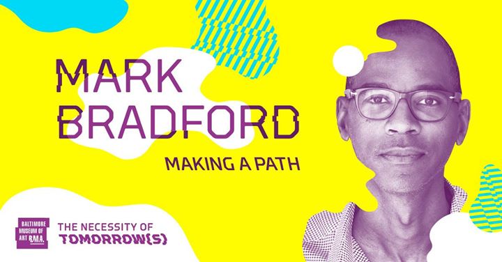
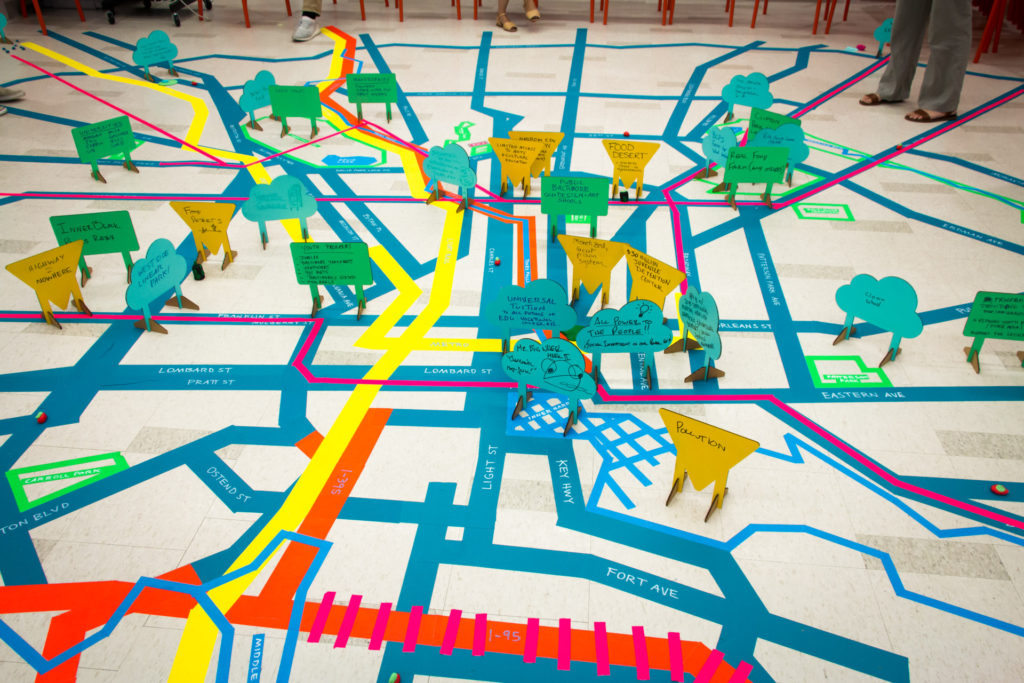
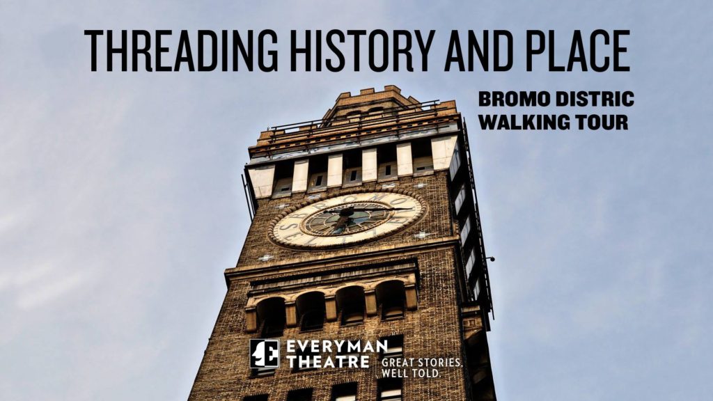
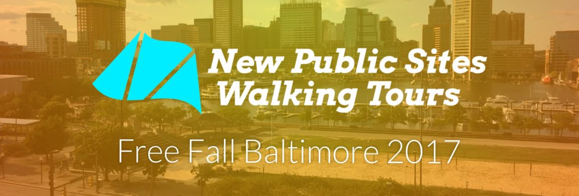
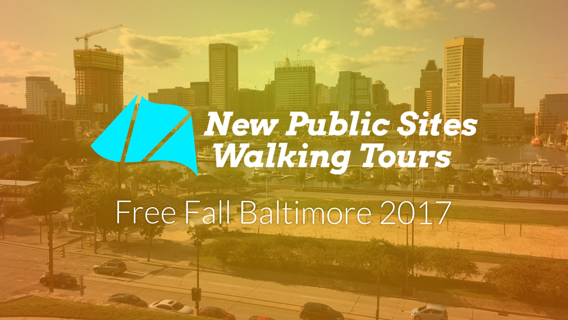
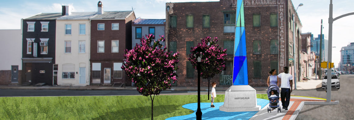
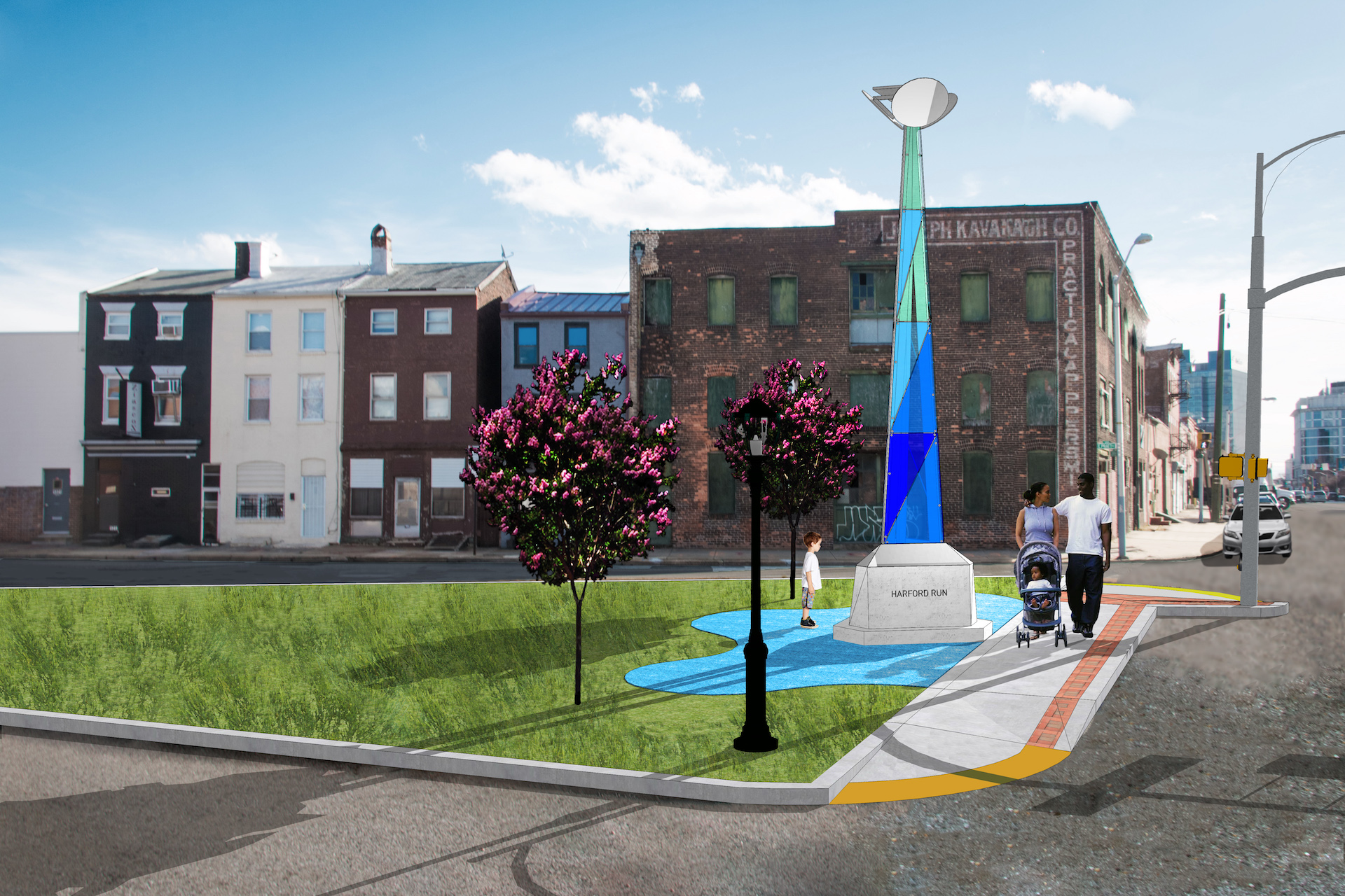
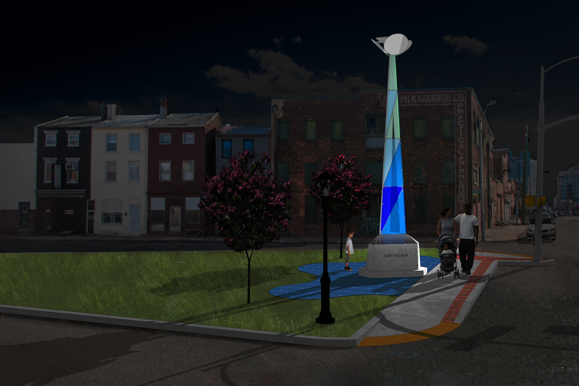
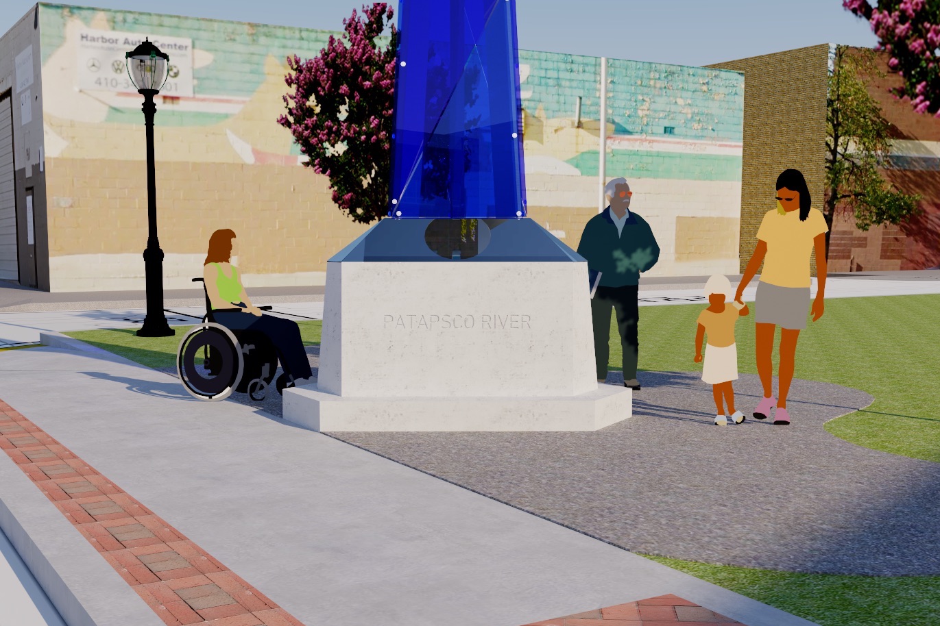
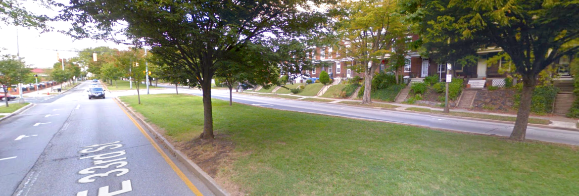
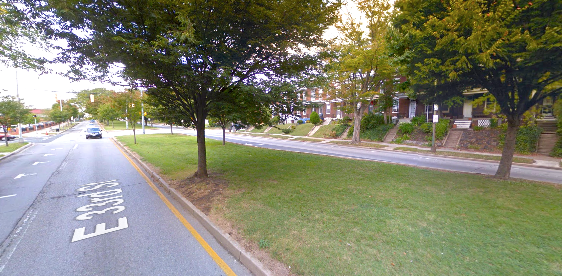
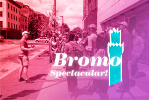
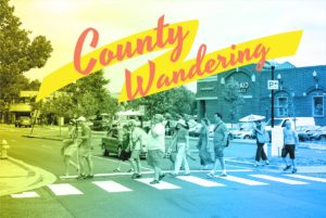
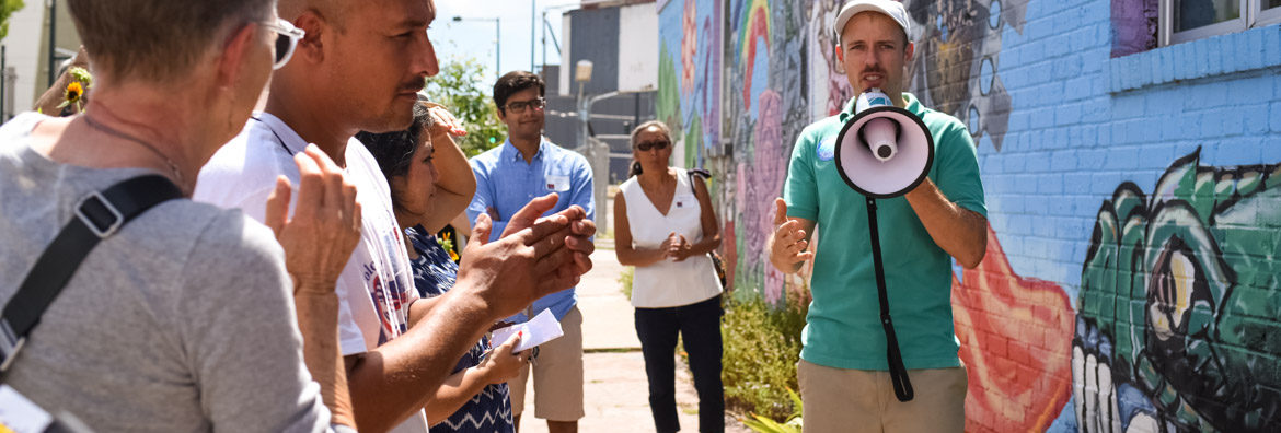
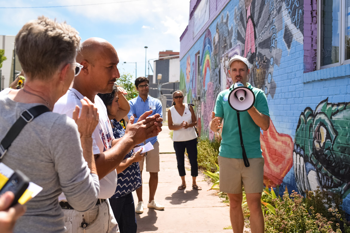
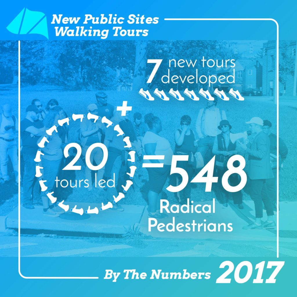
As we close out 2017 I’m thankful for the numerous neighbors, leaders, artists, and organizations I have had the honor of working with to Make Place Happen in Baltimore and beyond. From championing pedestrian accessibility around Druid Hill Park, to exploring the robust and emerging civic spaces and public art of Arlington County, to colorfully reconfiguring concrete paving for playful action, place is truly what we made of it. Public space is not just constructed out of tactile materials like pavement, landscaping, and benches, but also the intangible – knowledge, organizing, and programming. Through New Public Sites walking tours we poetically re-experienced everyday public spaces while learning from community leaders and civil servants how to affect change at the block level. Artscape showed that streets and bridges don’t have to be just for cars, but can also be spaces for ecstatic pedestrian interactions. Workshops like the Baltimore Museum of Art’s Visioning Home created spaces for inclusively mapping out creative futures for the city. I am inspired by my collaborators who believe that we can expand such temporary zones of autonomy into lasting places of accessibility, well-being, joy, and freedom.

Read More…

Map Baltimore’s Future then Thread History in Place

Necessity of Tomorrows BMA Mark Bradford + FutureSite Mapping

BMA Visioning Home Mapping with participant signs

Necessity of Tomorrows BMA Mark Bradford + FutureSite Mapping

The Necessity of Tomorrow(s): Mark Bradford—Making a Path + FutureSite Mapping

Saturday, November 11, 2017, 12pm-3:30pm
Free, Reservations Required
Location: Union Baptist Church
1219 Druid Hill Avenue, Baltimore, MD, 21217

How do you make a path to power where none exists? How do you assess a community’s needs and create access for a community to self-determine?

Back in September I had the honor of collaborating with the Baltimore Museum of Art on creating and leading an interactive mapping activity for the “Visioning Home” workshop. Participants challenged the entrenched narratives about Baltimore neighborhoods and envisioned possible futures through group discussions, exploring the museum’s collection, and posting their ideas as signs on a colorful floor map. Now we are about to do it again – this time as part of the BMA’s new series, The Necessity of Tomorrow(s), featuring luminary artist Mark Bradford. Bradford will be in conversation with BMA Director Christopher Bedford exploring how the artist grapples with “making a path,” and other key questions in his artistic practice and community-based work. Afterwards, I will be leading FutureSite – a collaborative activity to map the future of Baltimore City.

Free. Click here to learn more and reserve your spot: http://bmatomorrows.org

Threading History in Place Bromo District Walking Tour

Threading History in Place: Bromo District Walking Tour

Sunday, November 12, 2017, 11am-1pm
Tickets: $15 each (tour only)
Rain date is Nov. 18.
Meets at 315 W Fayette St, Baltimore, MD

You are invited to the final walking tour of my 2017 season: Threading History in Place.

Explore invisible public spaces and storied buildings that reflect the history of Baltimore’s fashion industry, department stores and garment district and learn about past and present efforts that shape the neighborhoods contained within the Bromo Arts and Entertainment District. Tour begins and ends at Everyman Theatre, where attendees may stay for the 2pm performance at an exclusive discounted rate. Produced in partnership with Everyman Theatre, Bromo Arts and Entertainment District, and Market Center Merchants’ Association.

Click here to purchase tickets: http://everymantheatre.org/bromo-district-walking-tour

2017 Free Fall Baltimore New Public Sites Walking Tours

New Public Sites Free Fall Baltimore 2017

New Public Sites Free Fall Baltimore 2017

As part of 12th annual Free Fall Baltimore, New Public Sites is offering three exciting tours – Mondawmin Crossings, Inner Harbor Baltimore Drift, and Druid Hill Reservoir Interchange. The fall 2017 New Public Sites walking tours series focuses on a combination of interlocking issues: pedestrian safety, the state of Baltimore’s water infrastructure, and access to public space.

These tours are made possible with support from Free Fall Baltimore and the Rails-to-Trails Conservancy. Free Fall Baltimore is produced by the Baltimore Office of Promotion & The Arts (BOPA) and presented by BGE with additional support from The Abell Foundation, Atapco Properties, Henry and Ruth Blaustein Rosenberg Foundation and the National Endowment for the Arts.

Mondawmin Crossings bannerMondawmin Crossings

October 14, 3-4:30pm Click here to learn more and register

Greater Mondawmin is a collection of strong neighborhoods sharing an array of educational, recreational, and shopping opportunities. Unfortunately, residents are unable to safely walk or bike to our local amenities due to streetscape barriers like the dangerous highways that ring Druid Hill Park and Mondawmin Mall. Mondawmin Crossings will be an interactive walking tour exploring opportunities for improving how local residents connect with our many valuable community places.

Inner Harbor Baltimore Drift bannerInner Harbor Baltimore Drift

October 21, 2-3:30pm Click here to learn more and register

Baltimore’s Inner Harbor is a celebrated success of waterfront redevelopment, but its spectacular looks disguise a contested past and challenging present. Inner Harbor Baltimore Drift tour participants will discover the real stories of how powerful people, visionary plans, and community movements are still transforming the former industrial wharf into a premiere public space for all.

Druid Hill Reservoir Interchange

[Rescheduled] Nov 4, 2-4pm Click here to learn more and register

Druid Hill Reservoir Construction Interchange will explore the overlapping embankments and sidewalks to nowhere between the Jones Falls Expressway and the Druid Hill Park Reservoir. The tour will focus on the history of the the park and surrounding highways, and details about the current reservoir construction project. Along the way, we will also share about the community movement afoot supporting pedestrian safety improvements around the park.

Periscope Public Art for Central Ave

Periscope site perspective SE final

Periscope site perspective SE final

FGLA’s Interactive Periscope Public Art for Central Avenue approved by Baltimore City

The Baltimore City Public Art Commission approved FGLA’s public art concept for an interactive Periscope tower and plaza at the intersection of Central Avenue and Pratt Street. This work is the percent-for-art commission part of the Central Avenue streetscape project. The Periscope’s angled mirrors will make it possible for people walking by to see elevated views of the neighborhood. Its color, form, and integrated plaza are inspired by local waterways, including City Springs, Harford Run, and the Patapsco River. The 25’ tall Periscope will be constructed of cast-in-place concrete, colored plexiglass supported by a welded frame, and surrounded by a plaza of integral color concrete. Inscribed on the obelisk pedestal will be the names of the three local water bodies that makeup the watershed where the Periscope stands.

The triangle crossing at Pratt Street offers a unique opportunity for a truly public, plaza-like place along Central Avenue. The angled intersection provides panoramic views of Baltimore’s diverse pasts and futures. From this vantage one can see historical rowhomes, public housing in transition, public art, and ongoing development up and down Central Avenue. The view facing east frames City Springs school, which takes its name from a spring that once existed where its athletic field now lays. Synthesizing these views, Periscope will stand as an obelisk-like monument to water in place and pedestrian oversight. Inverting the hierarchy of Baltimore’s omnipresent blue surveillance lights, the tower will empower pedestrians with elevated views of their surroundings while colorfully evoking the water cycle of precipitation, collection, and flow.

Periscope will be fabricated and installed in 2019.

Falon Graham Land Art (FGLA) is the public art team of Falon Mihalic and Graham Coreil-Allen.

Follow our public art process on instagram and twitter: @falonland @grahamprojects #publicart4centralave #fgla

Periscope site perspective SE night

Periscope nighttime view facing southeast.

Periscope streetview with mirror reflection

Periscope street view perspective featuring periscopic mirrors reflecting a nearby building.

Periscope site plan

Periscope plan feature blue integral color concrete plaza.

Dancing Forest is Live at Artscape!

Dancing Forest

Dancing Forest

Dancing Forest preview

[UPDATE: Click here to see the full documentation photos!]

Come down to the Artscape Charles Street Trail this weekend, July 21-23, to explore Dancing Forest, a kinetic environment of inflatable trees emblazoned with trail markers identifying Baltimore’s many classic places, features, and customs. Participants are encouraged to walk among and explore the the animated trees as they undulate in the sky. Up close, one will find an array of urban trail symbols, such as benches, snowballs, bikers, and buildings. Internal LED illumination of the sculptures allows nighttime exploration. Combining spectacular movement with urban wayfinding symbols, Dancing Forest creates an exciting, playful environment meant to inspire participants continue exploring Baltimore’s many intriguing places.

The Charles Street Trail is located on Charles Street between Penn Station and Lanvale Street.

Click here to learn more about Dancing Forest and its trail markers. Post your pictures to social media using the hashtag #DancingForest @grahamprojects for likes and retweets!